Antique Globes
The World at Your Fingertips
by Caroline Wallrock
 Nowadays it might seem incredible that, as late as the 1300s, Man believed the world was flat and that sailors departing for the unknown might drop off the end. Brave, enquiring minds were persecuted and even put to death for daring to think otherwise, despite the fact that the first known globe was made by Crates of Mallus in the 2nd century BC and Aristotle proved the world was round over 2,000 years ago by noticing the round shadow of the earth during an eclipse of the moon. In 1492 Martin Behaim of Nuremberg made the oldest western globe still in existence today but there were large expanses of sea to the West. Coincidentally Christopher Columbus and Amerigo Vespucci voyaged to the New World in that same year, although they initially hoped they had arrived in the Orient, and gradually some of the gaps in the known world’s surface were filled in.
This heralded the beginning of the golden age of sail where immense political power, sovereign territorial gain and untold wealth would be concentrated in the hands of those who controlled the high seas, especially the routes to the West; Portugal, Spain, the Netherlands, France and Britain. The dawn of maritime dominance coincided with the development of the printing press and immediately posed the challenge of producing a constantly changing world in the round. Monarchs and statesmen, explorers and buccaneers, clergymen and merchants all wanted the most up-to-date information. In addition, alongside their charts and hand-held instruments, navigators needed a different set of maps – those of the stars.
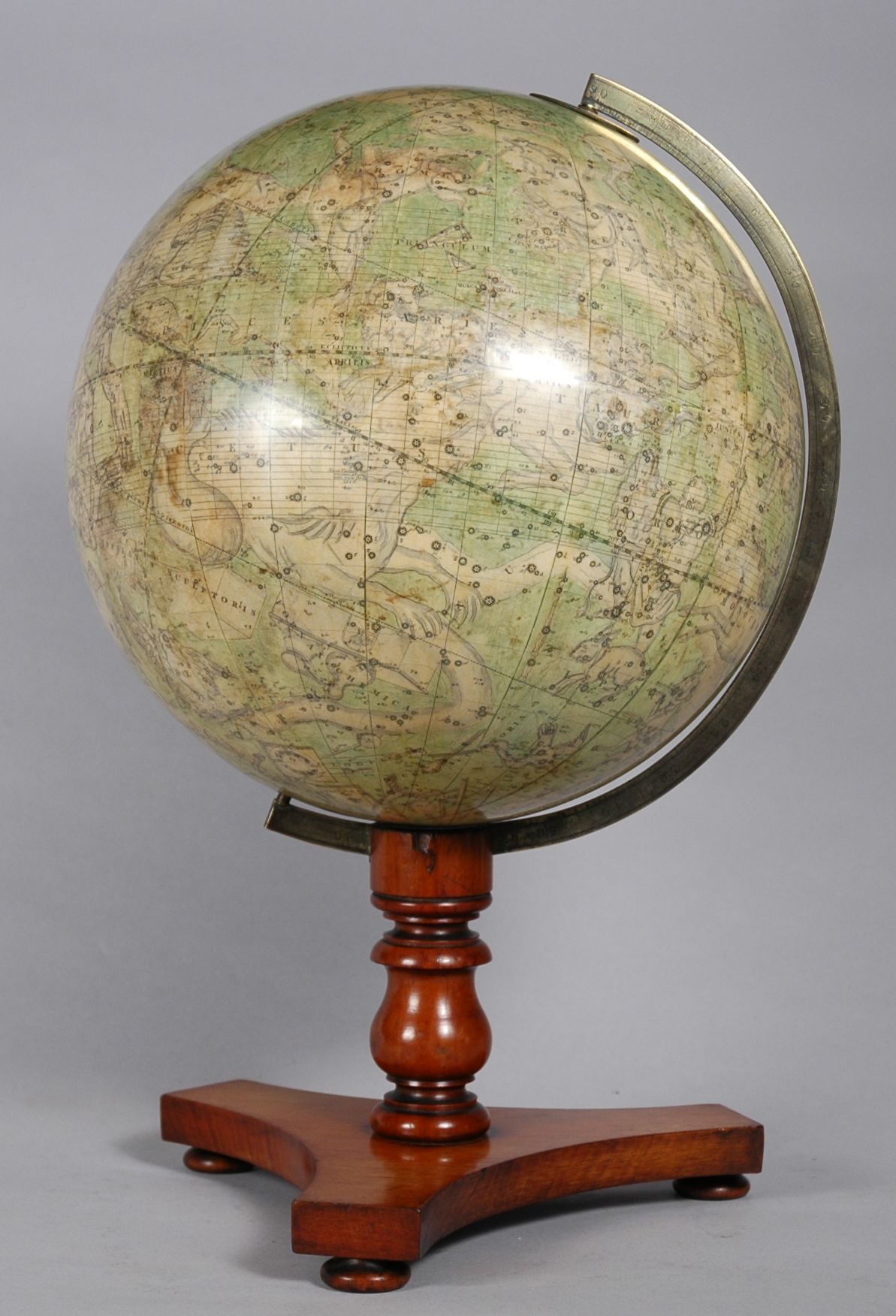
Enter the globe makers. The earliest globes were hand drawn or sometimes incised by cartographers directly onto metal spheres, often silver or gold. These were very costly, the preserve of royalty or the nobility. As demand grew scholars, scientists, engravers, printers and craftsmen combined to create a complex series of gores or elliptical strips of paper which could be printed in the flat, hand coloured and then carefully trimmed and pasted onto a globe which in turn was set into a stand which not only allowed it to be spun on its axis but also revolved to show both hemispheres. Meanwhile astronomers captured the scatter of constellations across the skies and translated it onto a corresponding sphere; initially these were concave to mirror the heavens as seen from earth.
 For the next 400 years returning explorers and sea captains would provide globe makers with their ships’ logs and detailed diaries leading to proud declarations of up-to-the minute papers for example “compiled from the most recent authentic surveys of British and foreign navigators and travellers,” or “all the Fixed Stars, Nebulae and Clusters ….together with the additional Stars noticed in the recent Catalogue of the British Association”, or “with New Discoveries and Political Alterations down to the present period” and so on.
Political and cultural developments dictated the changing centres for globe production. As we have seen above, the first centre of excellence was Nuremberg where Johann Schöner (1477-1547), a priest, teacher of mathematics and printer who cut his own wood blocks for his first set of gores, is credited with being the first person to make a pair of corresponding celestial and terrestrial globes.
In the next century successful Dutch expeditions round the Cape of Good Hope (1595), to Australia (1620) and New Zealand (1642-44) together with the granting of a monopoly to trade in Asia to the Dutch East India Company (V.O.C.) in 1602 combined to shift the focus of globe making to Amsterdam. Petrus Planicus, preacher, scientist, astronomer and cartographer added stars from the Southern Hemisphere including Crux (the Southern Cross) and Triangulum Australe with 135 further stars grouped into 12 constellations named after creatures from Asia and the West Indies; Chamaeleon, Apus (Bird of Paradise), Tucana, and so on.
By the late 17th century fashion was changing. Globes were status symbols for emperors and kings. They had to be splendid as well as scientifically accurate. In 1683 an Italian called Vincenzo Coronelli made the massive 3.85m ‘Marly’ globes for Louis XIV and the die was cast. They were so popular that Coronelli founded his workshop in Venice to produce 3-foot printed globes for nobility, archbishops, cardinals, ambassadors and scientists right across Northern Europe. Such valuable show-pieces were often set into ornate frames, for example a pair, now in Brussels, were supported by carved, painted and gilded allegorical figures of the Four Continents and the Four Elements.
Meanwhile French scientific and astronomical expeditions to far-flung Peking, Peru and Lapland combined with more reliable clocks, stronger telescopes in the newly founded Paris Observatory, 1666 and a study of the moons of the planet Jupiter led to the more accurate determination of longitude on French maps and globes. In London, around 1680, Joseph Moxon started a trend for pocket globes which were to become so popular and affordable that they were soon being mass produced.
 Like their European counterparts, British globe-makers benefitted from the scientific advances and explorations of their compatriots. The greatest of these was Sir Isaac Newton. His extraordinary new revelations about the earth and the planets led to an explosion in commercial instrument manufacture around 1700. Master craftsmen, unfettered by protectionist craft guilds like those in France, were able to meet the demand for ‘orreries’ (complicated mechanical models of the movement of planets round the sun), ‘planetaria’ ‘cometaria’, ‘lunaesolaria’, mathematical instruments, armillary spheres and of course globes. Nathaniel Hill, globe maker, advertises his shop thus ‘Makes and Sells all Sorts of Mathematical Instruments in Silver, Brass, Ivory or Wood, very curious, and true graduated both for Sea and Land with Books of their Use and the best Black-Lead Pencils. New and Correct GLOBES of 3.9.12 & 15 inches diameter.” George Adams based his celestial globes on the recent ‘star catalogue’ of John Flamstead, the Royal Astronomer at Greenwich and his later globes featured the discoveries of Captain James Cook’s three voyages of 1768-80.
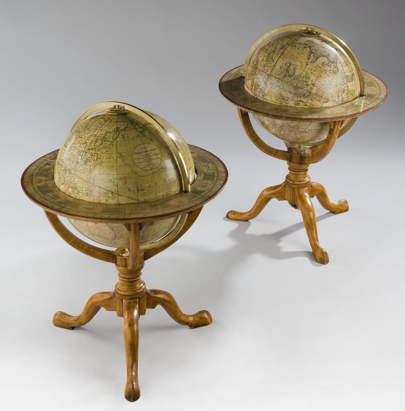
Now we enter the heyday of British globe manufacturing centred on London. The roll call includes Leonard and Richard Cushee, John Senex, the Adams family, James Ferguson, Malby and Sons and Charles Smith and Sons. The giants among them however, were Bardin and Son, Newtons and the Carys. These firms dominated globe production well into the 19th century.
The celebrated Cary family of cartographers and globe makers produced some of the greatest late Georgian globes. The firm was started in London in the late 18th century by John Cary (c. 1754-1835), an engraver and dealer in maps who often worked in partnership with his brother William Cary (c. l760-1825), a scientific instrument maker. John concentrated on geographical excellence rather than on decoration. In about 1820 the Cary brothers moved their business to 86 St. James’s Street, leaving the premises at 181 Strand to John Cary’s sons George (c. 1788-1859) and John Jr. (c. 1791 – 1852) who traded as G. & J. Cary until about 1850.
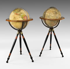
Shown here is a pair of Cary’s Library Globes, each globe is surmounted by a brass scale in a circular mahogany stand with three arched supports on a baluster and ring-turned column. One is inscribed “Cary’s New Terrestrial Globe exhibiting the late discoveries towards the North Pole together with every other improvement in Geography to the present time London, made and sold by J & W Cary” 86, St James’ Street, Jan 11th 1841 and the other “Cary’s New Celestial Globe on which is carefully laid down upwards of 3,500 stars… for the year 1800“.
Equally the Newton family were ranked among the leading English globe makers of the early 19th century. John Newton (1759-1844) trained under Thomas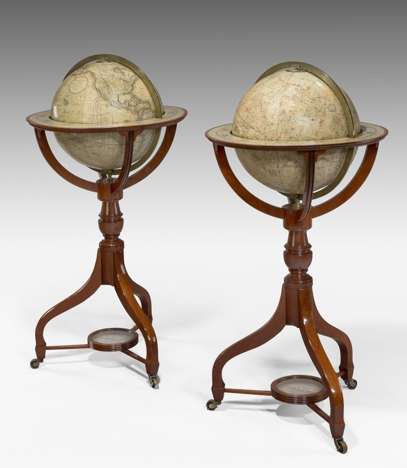 Bateman before founding his own company in 1780. In the early 1800s, John and his second son William (1786-1861) relocated to 97 Chancery Lane and traded under the name J & W Newton. From 1831 to 1841 another partner was added, civil engineer Miles Berry, and the company became Newton, Son and Berry. After 1841 ownership passed to the eldest son William Edward Newton (1818-79).
But what was happening on the other side of the Atlantic? Initially Americans relied on English maps and globes, but Independence and also greater mapping of central and western N. America required a domestic product. James Wilson (1763-1855) started the ball rolling, literally, with solid wood spheres covered in papers he researched in the Encyclopaedia Britannica. Having taught himself every aspect of globe making and even having made all the machines required, Wilson made his first “New American Thirteen Inch Globe” in 1810 and was running a full factory by 1815. Incidentally this was also the year in which Harvard College first listed a knowledge of Geography as an entry requirement. His globes charted the steady increase of States seeking entry into the Union and some have the prime meridian running through Washington.
So now globes had evolved from luxury status symbols to classroom essentials and educational tools. Two Boston booksellers, Joseph Loring and Gilman Joslin seized the chance to market globes alongside their printed maps and atlases and rose to such prominence that the former was awarded a silver medal in 1838 (although the globes themselves were made and engraved by W. Annin and G.Smith.)
By 1872, in Chicago, Rand McNally were cutting production and labour costs, by using full colour printing and cerography, an innovative wax-engraving print technique, so successfully that they quickly became, and remain to this day, one of the best known map publishing companies in the United States.
America also produced the first female globe innovator. In 1875 governess Ellen Eliza Fitz obtained a patent for a globe stand which was able to show the position of the sun and the length of days, nights, and even twilight for the whole year.
 Cook’s voyages completed the gaps in our knowledge of the Earth’s coastlines. The great 19th century explorers filled in the blank spaces of central Africa and the Polar Regions and by the 20th century scientists and explorers were turning their energies to the moon, nearby planets and distant galaxies. Global satellite navigation systems and the internet have replaced globes as a means of navigation and education but the allure of these spheres as snapshots of a different era still remains. It is fascinating to find a globe where Australia is New Holland or there is no Lake Victoria. The rise and fall of nations and Empires are mapped out in changing names and borders, when did the Indian Territory become Eastern Oklahoma or Newfoundland and Labrador join Canada. When did Yugoslavia disappear or Myanmar emerge? Great milestones in our development are often noted on globes, sometimes by hand; like the position of the first transatlantic telegraphic cable, the flights of the Graf Zeppelin and the Lindbergh, the construction of the Suez and Panama canals and even man-made islands in the shape of palm trees. Likewise as symbols of wealth and good taste, as examples of timeless elegance reflecting the style and fashions of bygone eras, globes have retained their cachet.
If you want to touch the stars, if you want the world at your fingertips, invest in a globe.